Going to a place for the first time can be scary because you’ve never taken that path before. If you are driving, you will probably use your GPS to help you with the route, but what some people don’t know is that you can do the same when taking transit with an app you probably already have on your smartphone. Google maps can help you select the best route, help you schedule a future trip, warn you if your bus is late or early, and even notify you when it is time to transfer to a different line. Cool, right? Check out below how to do it and explore all the amazing places Southern California has to offer.
Step 1: Open the Google maps app in your smartphone and click on “Transit” on the bottom right corner.

Step 2: Click on the top bar and type your destination address. We will be using the Staples Center as an example.

Step 3: Click on “Directions” on the bottom left corner.

Step 4 (Optional): If you are planning on leaving right away, jump to step 6. If you are planning a future trip, click below the transit icon where it says “Leave now” or has an estimated arriving time.

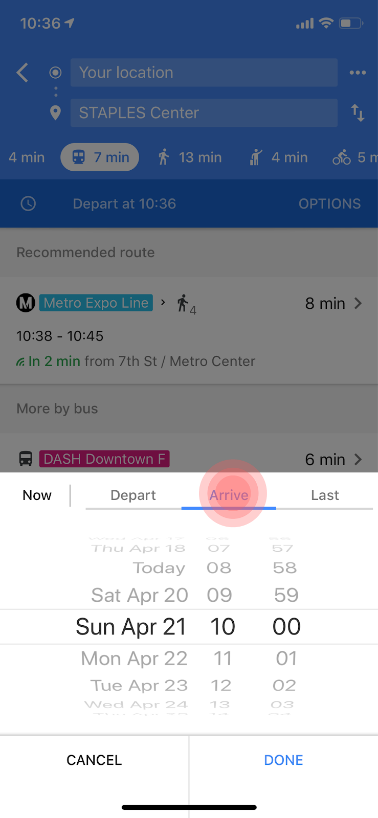
Step 5 (Optional): Select the date and time of your trip. You can decide between selecting the time you want to depart for your trip or the time you want to arrive at your destination. After you are done, click on “Done” on the bottom right corner.
Step 6: Select your preferred route based on time, walking time, cost, or number of transfers. This choice is up to you! Click on the routes to see more details about it.

Step 7: When you have selected your preferred route, you can track your transfers and next steps by keeping the app open or asking the app to do it for you. On this page, you can zoom in on the map, check where the stops are located, the direction of the line you have to take, and all other details you might need. If you scroll down, the app will give you more options for tracking the route for you. Follow to step 8 to learn more about it.

Step 8: On the bottom of your screen, Google maps will give options of adding your estimated travel time to your calendar, a reminder to leave on time for that route, or (our favorite) send you notifications for when and where to transfer lines. When you ask for notifications, you can distract yourself with a movie or book and not worry about missing your transfer stop. The app will warn you when your stop is near and where to walk after you leave the bus/train. Click on the bottom right button (highlighted in the image) to turn on the notifications.

Following these steps, your Google maps app will function as a transit GPS guiding you to all the places you want to visit. Have fun!